
Qualifications
State of Maine Professional Land Surveyors must comply with State of Maine Board of Licensure Laws and Rules in place by the Department of Professional & Financial Regulation. Licensure requires the passing of national and state examinations, as well as job training and experience requirements.
Our surveyors are each licensed under the State of Maine Department of Professional & Financial Regulation and have over 75 years of combined land surveying experience. Our staff also has diverse experience in additional fields that complement our abilities as land surveyors, such as GIS and GPS mapping, floodplain management, local history, forestry science, utility location, education, and real estate. We are also qualified and have experience in providing expert testimony in the event of a land boundary dispute.
Technical Skills
A licensed Professional Land Surveyor is competent in mathematics while performing field measurements and office computations. He or she has knowledge of current technology and up-to-date field equipment and software to collect, map, and analyze data.
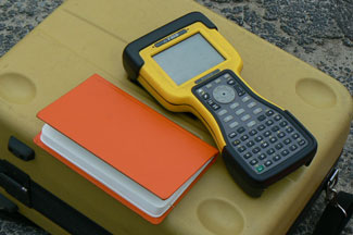
Our staff is experienced in the use of the latest survey field equipment and software. With use of the highly accurate Topcon DS-205 Robotic Total Station, the Topcon HiPer II Global Navigation Satellite System with integrated dual constellation receiver, the Topcon GPT-3003W Total Station, and the HyDrone-RCV-G2 catamaran platform for hydrographic surveying, we are able to collect data for any scope of service. We are currently licensed through the Federal Communications Commission (FCC) for GPS frequency, and able to horizontally place projects on a variety of coordinate systems, such as Maine State Plane, Universal Transverse Mercator, and Geographic (Latitude & Longitude) projected systems.
Vertical elevations can be provided on National Geodetic Vertical Datum of 1929 or North American Vertical Datum of 1988. Using continuous centimeter-level accuracy with ground augmentations, highly accurate surveying and mapping results can be rapidly obtained, thereby significantly reducing the amount of equipment and labor hours that are normally required of other conventional surveying and mapping techniques. We are also able to integrate field data into Geographic Information System format for various applications, using the ESRI geodatabase.
Ability to Research Historical Records
A Professional Land Surveyor should have a strong ability to research records, and related historical documents.
At Maine Coast Surveying, we are surveyors but we are also history enthusiasts. We are committed to providing our clients with a detailed and accurate history of their property. This process is required to perform a boundary survey in a correct manner.
The date of the operative document (a subdivision plan or a deed which first conveys a portion of land from a larger parcel of land) is of great importance. This date, relative to the dates of operative deeds for abutting parcels, determines sequence of lot creation and establishes “senior rights and junior rights”. It is common for a parcel to have both types of rights, but to different abutting parcels. Without defining the sequence of conveyance within the block being surveyed, it is very difficult to accurately determine the location of a boundary line in question or dispute. To be more specific, a land surveyor determines the creation date of individual boundary lines pertinent to the actual boundary lines being surveyed.
Aside from the obvious registry of deeds, we also collect information from appropriate municipal offices, abutters, other land surveyors, state agencies, registry of probate, county commissioner’s office, historical societies, etc. This gives us a deeper well of information to base our findings on, and a more accurate survey product for you, our client. As a requirement of our efforts, a land surveyor should always be ready, willing, and able to define a boundary line in relation to junior/senior rights and the operative conveyance.
A land surveyor is also required to evaluate the technology and method of document construction at the time of the operative document(s) creation.
In our research we must consider whether the operative document was created before the actual field measurements were made or whether the operative document was based on actual field measurement. This is very valuable in determining the intent of record documents. The operative document(s) may have been created 20, 50, 100, and sometimes in excess of 200 years ago. The field evidence initially called for in the operative document(s) is of primary importance to determine boundary line location. This is called “following the footsteps of the original surveyor”.
The image below shows an example of the various record calls which exist along a specific boundary line. Mortgage loan inspections are often incorrectly used as boundary surveys. In this example, if a mortgage loan inspection was performed on Parcel 1, Deed 6 would be used, and if performed on Parcel 2, Deed 5 would be used. If a boundary survey was performed on either parcel, Deed 1 would be used. It is crucial for all to understand that a mortgage loan inspection is intended to only evaluate loan investor risk and is extremely deficient of a boundary survey.

Boundary disputes can be created when differences of opinion occur in evaluating record information and field evidence found. At times, even identifying the physical location of pertinent documents can be very difficult. Without having an understanding of historical changes of counties and municipalities, locating pertinent documents would become much more difficult. Without an ability to identify the location of the pertinent operative documents, a land surveyor cannot accurately determine sequence of conveyance, and therefore cannot make a determination based on junior/senior rights.
Here are some examples of how our knowledge of town history helps to identify where property records can be found.
If a land surveyor is hired to perform a boundary survey in Scarborough, he or she should know that the pertinent documents relating to this parcel prior to 1760 would be located in York County, because Cumberland County was not established until November 1, 1760. Also, both counties were still within the boundaries of Massachusetts until 1820.
The office of Nadeau Land Surveys is located in Portland. Prior to 1814, our parcel was part of a larger tract of land within the boundaries of ancient Falmouth, within the Province of Maine, but still within the boundaries of the State of Massachusetts. From 1814-1871, it was within the boundaries of Westbrook, and only within the State of Maine since 1820. From 1871-1899, it was within the boundaries of Deering. In 1899, Deering merged into Portland. The deeds of conveyance within our chain of title would indicate four different towns and two different states, depending on the date of deed conveyance.
More information on the History of Cumberland County.
Second Tier Research – Going Beyond the Expected
We also perform "second tier" research when doing boundary surveys. Beyond creating a chain of title for each property, we find easements and other documents that would not have ordinarily been found because we check indexes for each owner of record from the time they purchased the property up to the present day.
Second tier research is not a common practice, but we have found it very helpful in identifying valuable record documents and providing a more accurate and thorough history of a property for our clients.
Knowledge of Common Legal Principals and Regulations
Working knowledge of federal, state, and local laws and regulations, especially those relating to property ownership and planning, is essential for a Professional Land Surveyor to do his or her job effectively.
At Maine Coast Surveying, not only are we very familiar with common property and boundary law as Surveyors, but with additional designations such as Certified Floodplain Manager, Certified Floodplain Surveyor, Underground Utility Locator, and Realtor under our roof, we have knowledge and experience that extends to a much larger scope of service. Our level of flood zone experience and education sets us apart from our competitors in knowledge of the National Flood Insurance Program (NFIP) and submissions to the Federal Emergency Management Agency (FEMA).
We work closely with municipalities and real estate consultants and are proud of our ability to see projects and transactions through to completion. We hold membership in many professional organizations, including the local chapter of the Maine Society of Land Surveyors. Jim also serves as a member of the State of Maine Board of Licensure for Professional Land Surveyors, and is a co-chair to the Federal Emergency Management Agency Sub-committee of the External Affairs Committee on the behalf of the National Society of Professional Land Surveyors
Customer Service
We provide our clients with services that go above and beyond their expectations. Regardless of the type of service we provide for a client, we understand that there are often many complex and time sensitive steps involved. We want to work closely with you, and any other parties involved, seeing that data is collected and documented in an efficient fashion, while guiding you through the process, and providing you with a quality final product that you can rely on for many years. We are fully insured and we stand by all our products with confidence.